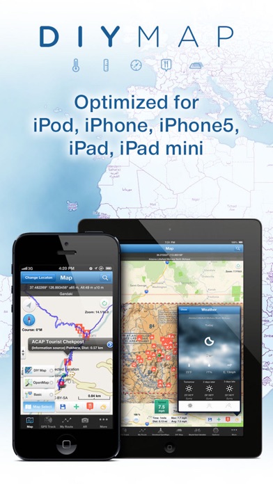
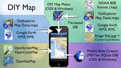
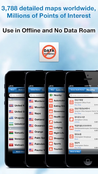
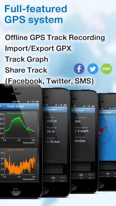
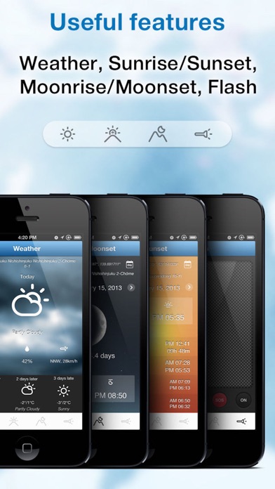
► iOS 10 Support! ►►►►► TUAW Review - "DIY Map GPS is a good app if you are a hiker, or someone who is going to an area where mapping data may be sparse." Do you need an offline map? DIY Map GPS offers you "Unique" features. The "DIY" in the app name is a clue that this is not just an offline map app. Basically you can directly download OpenStreetMap, OpenCycleMap, OpenSeaMap as an app which allows you to download maps of any place in the world. FREE downloads of 3,788 city maps worldwide and millions of Points of Interest are already listed. All you have to do is just download the maps app. Now, We would like to introduce the unique "DIY Map" feature. You can make your own offline maps in several ways outlined below. First, you can use map files with the formats listed below without conversion. - OziExplorer Map Data file(.map) - Google Earth KMZ/KML file - Kashmir3D KMZ/KML file Second, you can use the atlas(with MBTiles SQLite format) downloaded through the Mobile Atlas Creator. - Mobile Atlas Creator uses 25 world map sources to create an atlas. Mobile Atlas Creator is available for Mac OSX, Windows, Linux for free. (http://mobac.sourceforge.net/) Finally, You can convert a RasterMap file into a Tile-based DIY Map DB(.diymap) using the "DIY Map Maker" provided by us. "DIY Map Maker" is available for Mac OSX, Windows for free. (http://www.builtsoft.com) You can use NOAA RNC® (Raster Navigational Charts) as well as JPEG/TIFF for the DIY Map. NOAA provides weekly updates to the Raster Navigational Charts, which are available for free in the BSB format(.kap). NOAA RNC® are full-color digital images of NOAA's entire suite of paper charts. Here are the files supported by DIY Map Maker. - Supported file formats: TIFF/GeoTIFF, MrSID, OziExolorer Map Data(.map), NOAA BSB(.kap), ECW, Goole Earth KMZ/KML, Kashmir3D KMZ/KML, JPEG2000, Erdas HFA, JPEG and more… There are lots of Free Raster Charts provided by different organizations or countries. Please visit us(http://www.builtsoft.com) for Free Raster Charts details. ► DIY Map GPS is featured on TUAW(The Unofficial Apple Weblog). We believe it would be very useful for all world travelers. ►►►►► TUAW Review - "DIY Map GPS is a good app if you are a hiker, or someone who is going to an area where mapping data may be sparse." "DIY Map GPS is a GPS navigation solution for those who like to create or annotate their own maps." "If you have specialized scientific or geographic uses this app is a great place to bring your data together." ► Features - Optimized for iPhone4/5, iPad, iPad mini, iPod touch! - FREE download of 3,788 City Maps worldwide - FREE download of Millions of Points of Interest - Full-featured GPS system - Maps, POI, GPS 100% offline. No network or Wi-Fi required. - Useful features (Weather, Sunrise/Sunset, Moonrise/Moonset, Flash) - Unique DIY Map feature - Supported DIY Map files: Google Earth KMZ/KML, NOAA BSB, OziExplorer Map Data(.map), Mobile Atlas Creator MBTiles SQLite(.mbtiles), Kashmir3D KMZ/KML, TIFF/GeoTIFF, MrSID, ECW, JPEG2000, Erdas HFA, JPEG and more… ► Mobile Atlas Creator Map sources - OpenStreetMap 4umaps.eu (Europe) - FAA Sectional Charts - Freemap Slovakia Car Atlas - Freemap Slovakia Cycle Map - Freemap Slovakia Hiking - OpenStreetMap MapQuest - OpenStreetMap Mapnik - Moldova (point.md) - nztopomaps.com (New Zealand only) - OpenStreetMap CloudMade Defalut Style - OpenStreetMap Public Transport - OSMapa-Topo (Poland) - OSMapa-Topo with contours (PL) - Open Piste Map - OpenSeaMap - OpenStreetMap Hikebikemap.de - Turaterkep (Hungary) - UMP-pcPL (Poland only) - Reit - und Wanderkarte ($Abo) - Chartbundle US Area Charts - Chartbundle US Enroute High/Low Charts - Chartbundle US Sectional Charts - Chartbundle US Terminal Area Charts - Chartbundle US World Areonautical Charts ► GPS WARNING - Continued use of GPS running in the background can dramatically decrease battery life. ► Homepage: http://www.builtsoft.com