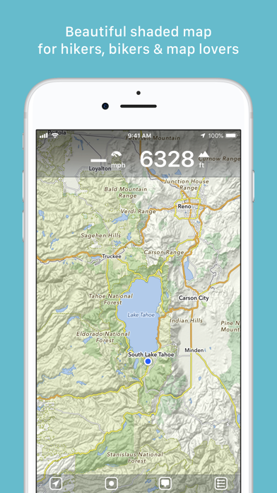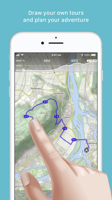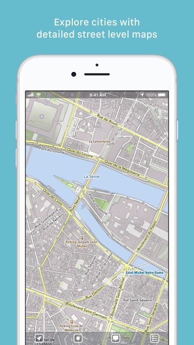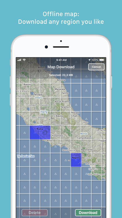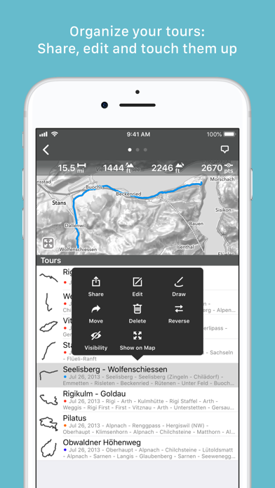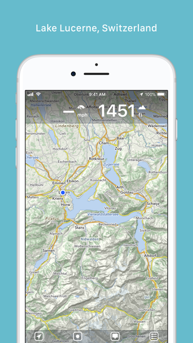
“MapOut saves the day by using a simple interface to draw routes, and check out elevation profiles… I’m pretty blown away by its capabilities.” – Alee from cyclingabout.com Offline map covering the whole world for iPhone and iPad. Almost as beautiful as a paper map - only more versatile. - For hikers: With an easy-to-read representation of the terrain, even in the furthest corners without internet - For cyclists: With cycling route network, speed and distance display - For city travelers: City maps with tourist information - For the connoisseur: Simply beautiful map to look at 3D tilt view - Tilt the device in any direction to get a better impression of the terrain. More information on https://mapout.app. Search feature - Search for places, streets, mountains, etc. No internet connection required. Map material - MapOut is based on the OpenStreetMap project, the “Wikipedia of Maps” - you can make corrections and additions yourself on OpenStreetMap.org. The latest maps are delivered with periodic updates. - Download the regions of your choice - the maps can now be displayed without an internet connection (offline map). Tours - Drawing: Draw your own routes and waypoints directly on the map. Retouch existing tours and imported GPX files or let them directly snap to the road network. - Import: With a free “MapOut.me” account you can send directions by email to your device. GPS-Tours can be found as gpx or kml files on many websites with tips for hiking or biking (e.g. on www.gpsies.com) Record: Take recordings of your own tours and share them with friends. Information: Quick overview of each tour - length, altitude change, map section and route profile Map view - Fast map display (hardware accelerated) - Step-free zoom, always a pixel-perfect map - Topographical map with contour lines and shading - Selectable overlays: Bike/hike/ski routes, sightseeing, public transport Find all answers to your questions in our user manual: https://mapout.app/manual Map data © OpenStreetMap contributors (https://www.openstreetmap.org/copyright)